
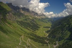
Major Mountain Roads, Passes and Tunnels of Europe
Hit the high road on some of the highest tarmac in Europe
Driving through mountain passes can be challenging, especially when you're towing a caravan or operating a larger motorhome. It's important to consider your power-to-weight ratio and the driving conditions before attempting these routes. If you have any doubts about your vehicle's suitability or the weather conditions, it's advisable to stick to motorway routes that traverse mountain ranges whenever possible.
Mountain Passes and Driving
The tables provided below indicate which passes are unsuitable for caravans and those where caravans are not permitted at all. While motorhomes generally do not fall under these restrictions, vehicles with relatively low power or excessive size should seek alternative routes. At the base of a pass, road signs may indicate access restrictions or provide advice, particularly for heavy, long or wide vehicles. Warning notices are usually displayed if a pass is closed or if the use of chains or winter tyres is mandatory.
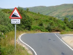
Caravanners should pay close attention to gradients and traffic/road conditions when traversing passes. The maximum gradient typically occurs on the inside of bends, and exercise caution if you need to change lanes. Always shift to a lower gear before navigating hairpin bends and give priority to ascending vehicles.
On mountain roads, it's not just the gradient that puts a strain on your vehicle but also the duration of the climb and the decrease in power at higher altitudes. The power loss can be as much as 10% at an altitude of 915 meters (3,000 feet) and even more as you go higher. To minimise the risk of engine overheating, it's advisable to tackle high passes during the cooler parts of the day, avoid excessive acceleration, and maintain steady engine performance.
Keep an eye on the water and oil levels. In the event of a radiator overheating, safely pull off the road, turn on the heater and blower to the maximum, and switch off the air conditioning. Exercise caution when opening the bonnet, and watch out for steam when opening the radiator. Never pour cold water into a boiling radiator, as it may cause it to crack. Also, check that the radiator intake is clear of debris that may have been sucked in during the journey.
Descending over long distances can lead to overheating of the brakes. It's important to select the appropriate gear for the gradient and avoid excessive use of the brakes. Even if you're using engine braking to control your speed, be aware that the overrun mechanism on caravans may activate the brakes and cause them to overheat.
Travelling at higher altitudes can result in a pressure build-up in tanks and water pipes. To prevent this, slightly open the blade valve of your portable toilet and open a tap slightly.
Sorry, this YouTube video cannot be displayed.
The following consent is required:
Tracking & performance, Targeting & advertising.
Please note that the opening and closing dates provided in the following tables are approximate. If you plan to travel across borders during the late afternoon or early morning, make sure to check the border's opening times, as some may close at night. The listed gradients represent the maximum slopes you may encounter on the pass and maybe even steeper on the inside of curves, particularly on older roads.
Gravel surfaces, including dirt and stone chips, can vary significantly. They may be dusty when dry and slippery when wet. Where known, the presence of this type of surface has been indicated. In favourable weather conditions, winter tyres or snow chains are typically only necessary on very high passes or for short periods in early or late summer. However, during winter conditions, you will likely need to use them at altitudes above 600 meters (approximately 2,000 feet). Find out more about winter driving in our Travel Advice hub.
Tunnels of the Alps and Pyrenees
In Europe, long tunnels are a more common sight, especially in mountainous areas, compared to the UK. Major tunnels usually have tolls associated with their use.

Strictly adhere to "No overtaking" signs and never cross central single or double lines. In twin-tube tunnels where overtaking is allowed, be cautious as it's easy to misjudge distances and speed once inside. To minimise the impact of exhaust fumes, close all car windows and set the ventilator to circulate air, or use the air conditioning system with the recycled air option.
If your vehicle breaks down, try to reach the nearest lay-by and call for assistance using an emergency phone. If reaching a lay-by is not possible, and it's safe to do so, place your warning triangle at least 100 meters behind your vehicle. Most modern tunnels are equipped with video surveillance systems to ensure prompt emergency response. It's worth noting that breakdowns in tunnels often occur due to running out of fuel, so ensure you have enough fuel before entering.
When travelling through road tunnels, it is generally required to use dipped headlights unless stated otherwise, even if the road appears well-lit. In some countries, police conduct spot checks and impose on-the-spot fines for non-compliance. During winter, wheel chains may be necessary on tunnel approaches, but they must not be used inside tunnels. Lay-bys are available for the removal and refitting of wheel chains.
Interactive Map of Mountain Roads, Passes and Tunnels
Sorry, this content can not be displayed.
The following consent is required:
Required cookies, Functionality, Tracking & performance, Targeting & advertising.
Use the filter to discover the passes and mountain roads which are passable with a caravan within each region. Click on the 'MapHub' link at the bottom of the map to enlarge the map.
Embed this interactive map on your website
Please include an attribution to alanrogers.com with this graphic.
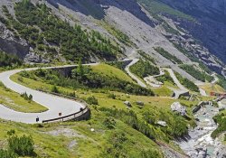
The Alps
The Alps present an awe-inspiring backdrop for driving enthusiasts, featuring winding roads that meander through breathtaking landscapes.
As you embark on your driving adventure, it is important to ensure you adhere to local regulations, stay informed about road conditions, and stay updated on the weather forecast.
By doing so, you can fully immerse yourself in the scenic beauty and experience the exhilaration of driving along these magnificent routes.
Passable with a Caravan - Alps
| Name | From / To | Altitude / Max. Gradient | Open Dates | Road Name / Number | Width / Height Restrictions | Notes |
| Achenpass | Achenwald (AT) / Glashütte (DE) | 941m - 3087ft 4% | Usually Open | B181/307 | N/a | Well-made road - Mild gradient. |
| Passo dell'Aprica | Tresenda (IT) / Edolo (IT) | 1176m - 3858ft 8% | Usually Open | SS39 | Minimum Road Width: 4m (13'1") | Good road surface - Narrow in places with protruding rock - Poor weather conditions can narrow the road considerably - Extreme caution for caravanners. |
| Col des Aravis | La Clusaz (FR) / Flumet (FR) | 1498m - 4915ft 9% | Closed occasionally between December and March | D9090 | Minimum Road Width: 4m (13'1") | A fairly easy road - Some single line traffic in places - Poor surface conditions on the Chamonix side. |
| Name | From / To | Altitude / Max. Gradient | Open Dates | Road Name / Number | Width / Height Restrictions | Notes |
| Ballon d'Alsace | Giromagny (FR) / St Maurice-sur-Moselle (FR) | 1178m - 3865ft 11% | Closed occasionally between December and March | D465 | Minimum Road Width: 4m (13'1") | A fairly straightforward route - Narrow in places - Numerous bends. |
| Col Bayard | Chauffayer (FR) / Gap (FR) | 1248m - 4094ft 14% | Usually open | N85 | Minimum Road Width: 6m (19'8") | Part of the "Route Napoléon" - Fairly easy - Steepest from the South with several hairpin bends - Negotiable North to South by caravans via D1075 and col-de-la-Croix Haute, avoiding Gap. |
| Passo del Bernina | Pontresina (CH) / Poschiavo (CH) | 2330m - 7644ft 12.5% | Closed occasionally between December and March | 29 | Minimum Road Width: 5m (16'5") Maximum Vehicle Width: 2.25m (7'6") | Some narrow one-lane sections on the South side. |
| Name | From / To | Altitude / Max. Gradient | Open Dates | Road Name / Number | Width / Height Restrictions | Notes |
| Passo Del Bracco | Riva Trigoso (IT) / Borghetto di Vara (IT) | 613m - 2011ft 14% | Usually open | SS1 | Minimum Road Width: 5m (16'5") | More severe than the height would suggest due to the number of hairpins and volume of traffic - Passing is difficult - Cross early to avoid traffic - Alternate toll route via A12 Motorway. |
| Brünig Pass | Brienzwiler Station (CH) / Giswil (CH) | 1007m - 3340ft 8.5% | Usually open | 4 | Minimum Road Width: 6m (19'8") Maximum Vehicle Width: 2.5m (8'2") | Easy but winding route - Heavy traffic at weekends - Frequent lay-bys. |
| Col de Bussang | Thann (FR) / St Maurice-sur-Moselle (FR) | 731m - 2398ft 7% | Usually open | N66 | Minimum Road Width: 4m (13'1") | Easy route with fine views. |
| Name | From / To | Altitude / Max. Gradient | Open Dates | Road Name / Number | Width / Height Restrictions | Notes |
| Col de Cabre | Luc-en-Diois (FR) / Aspres-sur-Buëch (FR) | 1180m - 3871ft 9% | Usually open | D93/D993 | Minimum Road Width: 5.5m (18') | Easy route, winding towards the Col-de-Cabre. |
| Campolongo Pass | Covara-in-Badia (IT) / Arabba (IT) | 1875m - 6152ft 12.5% | Closed occasionally between December and March | SP244 | Minimum Road Width: 5m (16'5") | Winding but scenic ascent - Long level summit followed by easy descent - Good surface. |
| Col de la Croix Haute | Monestier-de-Clermont (FR) / Aspres-sur-Buëch (FR) | 1179m - 3868ft 7% | Usually open | D1075/N75 | Minimum Road Width: 5.5m (18') | Well-engineered road with several hairpin bends on the North side. |
| Name | From / To | Altitude / Max. Gradient | Open Dates | Road Name / Number | Width / Height Restrictions | Notes |
| Falzarego Pass | Cortina-d'Ampezzo (IT) / Andraz (IT) | 2117m - 6945ft 8.5% | Closed occasionally between December and April | R48 | Minimum Road Width: 5m (16'5") | Well-engineered road with numerous blind hairpin bends - Used by coach tours, so it can get busy. |
| Col de la Faucille | Gex (FR) / Morez (FR) | 1323m - 4341ft 10% | Usually open | N5 | Minimum Road Width: 5m (16'5") | Fairly winding route - Negotiable by caravans, but it might be better to follow the route via La Cure - St-Cergue - Nyon. |
| Fern Pass | Nassereith (AT) / Lermoos (AT) | 1209m - 3967ft 8% | Usually open | 179 | Minimum Road Width: 6m (19'8") | Intermittent obstructions in winter - Surface can be slippery in wet conditions - Heavy traffic on Summer weekends - Connects to Holzleiten Sattel Pass (which is not recommended for caravans) at the Southern end for onward travel to Innsbruck. |
| Name | From / To | Altitude / Max. Gradient | Open Dates | Road Name / Number | Width / Height Restrictions | Notes |
| Flüela Pass | Davos-Dorf (CH) / Susch (CH) | 2383m - 7818ft 12.5% | Closed occasionally between November and May | 28 | Minimum Road Width: 5m (16'5") Maximum Vehicle Width: 2.3m (7'6") | Easy ascent from Davos - Some acute hairpin bends on the Eastern side. |
| Col de la Forclaz | Martigny (CH) / Argentière (FR) | 1527m - 5010ft 8.5% | Forclaz - Usually open / Montets - Closed occasionally between December and early April | D1506/N506 | Minimum Road Width: 5m (16'5") Maximum Vehicle Width: 2.5m (8'2") | Long hard climb on good surfaces out of Martigny - Narrow and rough over the Col-des-Montets |
| Gorges-du-Verdon | Castellane (FR) / Moustiers-Ste Marie (FR) | 1032m - 3386ft 9% | Usually open | D952 | Minimum Road Width: appx. 5m (16'5") | Passing over Col-d'Ayen and Col-d'Olivier - Moderate gradients, but slow, narrow and winding - Possibly heavy traffic. |
| Name | From / To | Altitude / Max. Gradient | Open Dates | Road Name / Number | Width / Height Restrictions | Notes |
| Grand St Bernard Pass | Martigny (CH) / Aosta (IT) | 2469m - 8100ft 11% | Usually closed from October to June | 21/E27 | Minimum Road Width: 4m (13'1") Maximum Vehicle Width: 2.5m (8'2") | Modern road as far as road tunnel, then narrow - Suitable for caravans using the tunnel - Pass feasible for small caravans, but not recommended. |
| Grimsel Pass | Interkirchen(CH) / Gletsch (CH) | 2164m - 7100ft 10% | Usually closed from mid-October to late June | 6 | Minimum Road Width: 5m (16'5") Maximum Vehicle Width: 2.25m (7'6") | Fairly easy modern road - Heavy traffic at weekends - Long, winding ascent with final hairpin bends - Terraced descent with six tight hairpins - Good surface - Fine views. |
| Großglockner High Alpine Road | Bruck an der Großglocknerstraße (AT) / Heiligenblut (AT) | 2503m - 8212ft 12.5% | Usually closed from late October to early May | 107 | Minimum Road Width: 5.5m (18') | Well-engineered road with many hairpin bends - Moderate, but long ascent/descent - Best negotiated South to North by caravan - Avoid the sideroad to the highest point at Edelweißspitze if towing as the road is very steep and narrow - Toll charged - Road closed from 22:00 to 05:00 in summer - Alternative route via Felbertauerntunnel between Lienz and Mittersil (Toll) |
| Name | From / To | Altitude / Max. Gradient | Open Dates | Road Name / Number | Width / Height Restrictions | Notes |
| Jaun Pass | Bulle (CH) / Reidenbach (CH) | 1509m - 4959ft 14% | Usually open | 11 | Minimum Road Width: 4m (13'1") Maximum Vehicle Width: 2.25m (7'6") | A modern but narrow road, with some poor sections on the ascent and several hairpin bends on the descent. |
| Julier Pass | Tiefencastel (CH) / Silvaplana (CH) | 2284m - 7493ft 13% | Usually open | 3 | Minimum Road Width: 4m (13'1") Maximum Vehicle Width: 2.5m (8'2") | A well-engineered road, approached from Chur via Stils - Negotiable by caravans from North to South, but a long haul with tight hairpin bends. |
| Katschberg Pass | Spittal-an-der-Drau (AT) / St Michael (AT) | 1641m - 5384ft 20% | Usually open | 99 | Minimum Road Width: 6m (18'9") | Good wide road with no hairpin bends - Steep gradients, particularly from the South - Suitable for light caravans only - Alternative route via the parallel A10/E55 and road tunnels. |
| Name | From / To | Altitude / Max. Gradient | Open Dates | Road Name / Number | Width / Height Restrictions | Notes |
| Larche (della Maddalena) Pass | La Condamine-Chatelârd (FR) / Vinadio (IT) | 1994m - 6542ft 8.5% | Occasionally closed between December and March | D900/S21 | Minimum Road Width: 3.5m (11'6") | An easy road with a long steady ascent from the French side - Numerous hairpin bends on the Italian side - Ample summit parking. |
| Col du Lautaret | Le Bourg-d'Oisans (FR) / Briançon (FR) | 2058m - 6725ft 12.5% | Occasionally closed between December and March | D1091 | Minimum Road Width: 4m (13'1") | A modern road, but unguarded in places - Some narrow tunnels - Passable with care by caravans. |
| Col des Lèques | Barrême (FR) / Castellane (FR) | 1146m - 3760ft 8% | Usually open | D4085 | Minimum Road Width: 4m (13'1") | "Route Napoléon" - Light traffic - Excellent surface - Narrow in places on Northern ascent - Numerous hairpin bends on the Southern side. |
| Name | From / To | Altitude / Max. Gradient | Open Dates | Road Name / Number | Width / Height Restrictions | Notes |
| Lukmanier (Lucomagno) Pass | Olivone (CH) / Disentis (CH) | 1916m - 6286ft 9% | Usually closed from early November to late May | Passo del Lucomagno | Minimum Road Width: 5m (16'5") Maximum Vehicle Width: 2.25m (7'6") | Rebuilt modern road. |
| Maloja Pass | Silvaplana (CH) / Chiavenna (CH) | 1815m - 5955ft 9% | Usually open | 3/S37 | Minimum Road Width: 4m (13'1") Maximum Vehicle Width: 2.5m (8'2") | South-facing escarpment - Fairly easy route, but numerous hairpin bends on the descent - Negotiable by caravans, but may be difficult on the ascent. |
| Mauria Pass | Lozzo di Cadore (IT) / Ampezzo (IT) | 1298m - 4258ft 7% | Usually open | S52 | Minimum Road Width: 5m (16'5") | A well-designed road with easy winding ascent/descent. |
| Name | From / To | Altitude / Max. Gradient | Open Dates | Road Name / Number | Width / Height Restrictions | Notes |
| Mendola Pass | Appiano/Eppan (IT) / Sarnonico (IT) | 1363m - 4472ft 12.5% | Usually open | S42 | Minimum Road Width: 5m (16'5") | A fairly straightforward, well-guarded but winding road - Numerous hairpin bends - Take care for overhanging cliffs, especially if towing - Eastern side to Bolzano is narrow and can be difficult on busy days when it is not recommended for caravans. |
| Col de Mont-Cenis | Lanslebourg (FR) / Susa (IT) | 2083m - 6834ft 12.5% | Usually closed from November to May | D1006/S25 | Minimum Road Width: 5m (16'5") | Approach via an industrial valley - Easy route with fine views - Long descent into Italy with few stopping places - Alternate route via Fréjus road tunnel. |
| Monte Croce di Comelico (Kreuzbergpass) | San Candido (IT) / Santo-Stefano-di-Cadore (IT) | 1636m - 5368ft 8.5% | Usually open | S52 | Minimum Road Width: 5m (16'5") | A winding road with fine scenery - Moderate gradients. |
| Name | From / To | Altitude / Max. Gradient | Open Dates | Road Name / Number | Width / Height Restrictions | Notes |
| Col du Montgenevre | Briançon (FR) / Cesana-Torinese (IT) | 1850m - 6070ft 9% | Usually open | N94/S24 | Minimum Road Width: 5m (16'5") | Some tight hairpin bends on the French side - Roads have been widened and improved on the Italian side - Some freight traffic, and caravans may have to give way to larger vehicles. |
| Col des Mosses | Aigle (CH) / Château-d'Oex (CH) | 1445m - 4740ft 8.5% | Usually open | 11 | Minimum Road Width: 4m (13'1") Maximum Vehicle Width: 2.25m (7'6") | A modern road - Aigle side is steeper and narrower in places. |
| Nufenen (Novena) Pass | Ulrichen (CH) / Airolo (CH) | 2478m - 8130ft 10% | Usually closed from mid-October to mid-June | Nufenenstrasse | Minimum Road Width: 4m (13'1") Maximum Vehicle Width: 2.25m (7'6") | Approach roads are narrow, but the road over the pass is good - Negotiable with care - Long drag from Ulrichen. |
| Name | From / To | Altitude / Max. Gradient | Open Dates | Road Name / Number | Width / Height Restrictions | Notes |
| Ofen (Fuorn) Pass | Zernez (CH) / Santa Maria Val Müstair (CH) | 2149m - 7051ft 12.5% | Usually open | 28 | Minimum Road Width: 4m (13'1") Maximum Vehicle Width: 2.25m (7'6") | A good road through the Swiss National Park. |
| Col du Pillon | Le Sépey (CH) / Gsteig (CH) | 1546m - 5072ft 9% | Occasionally closed in January and February | Rte du Pillon | Minimum Road Width: 4m (13'1") Maximum Vehicle Width: 2.25m (7'6") | A comparatively easy modern road. |
| Plöcken (Monte Croce Carnico) Pass | Kötschach (AT) / Paluzza (IT) | 1362m - 4468ft 14% | Occasionally closed from December to April | 110 | Minimum Road Width: 5m (16'5") | A modern road with long reconstructed sections - Closed occasionally to caravans due to heavy traffic in summer - Possible border delays - Easier from the North, a long slow twisty pull from the South. |
| Name | From / To | Altitude / Max. Gradient | Open Dates | Road Name / Number | Width / Height Restrictions | Notes |
| Pordoi Pass | Arabba (IT) / Canazei (IT) | 2239m - 7346ft 10% | Occasionally closed from December to April | S48 | Minimum Road Width: 5m (16'5") | An excellent modern road with numerous blind hairpin bends - Used by coach tours - Long drag when combined with the Falzarego Pass. |
| Pötschen Pass | Bad Ischl (AT) / Bad Aussee (AT) | 982m - 3222ft 9% | Usually open | 145 | Minimum Road Width: 7m (23') | A modern road with fine scenery. |
| Radstädter-Tauern Pass | Radstädt (AT) / Mauterndorf (AT) | 1738m - 5702ft 16% | Occasionally closed from January to March | 99 | Minimum Road Width: 5m (16'5") | The Northern ascent is steep but not difficult otherwise - May be negotiable by light caravans - Alternative route via parallel A10 toll road. |
| Name | From / To | Altitude / Max. Gradient | Open Dates | Road Name / Number | Width / Height Restrictions | Notes |
| Reschen (Résia) Pass | Spondigna (IT) / Pfunds (AT) | 1504m - 4934ft 10% | Usually open | S40/180 | Minimum Road Width: 6m (19'8") | A good alternative to the Brenner Pass - Fine views - No stopping places. |
| Passo Rolle | Predazzo (IT) / Mezzano (IT) | 1970m - 6463ft 9% | Occasionally closed between December to March | S50 | Minimum Road Width: 5m (16'5") | Numerous hairpin bends on both sides - Fine views - Good road surface. |
| St Gotthard (San Gottardo) Pass | Göschenen (CH) / Airolo (CH) | 2108m - 6916ft 10% | Usually closed between mid-October and early-June | A2/E35 | Minimum Road Width: 6m (19'8") Maximum Vehicle Width: 2.5m (8'2") | Modern, fairly easy two/three lane road - Heavy traffic - Alternative road tunnel. |
| Name | From / To | Altitude / Max. Gradient | Open Dates | Road Name / Number | Width / Height Restrictions | Notes |
| San Bernardino Pass | Mesocco (CH) / Hinterrhein (CH) | 2066m - 6778ft 10% | Usually closed between October and late-June | A13/E43 | Minimum Road Width: 4m (13'1") Maximum Vehicle Width: 2.25m (7'6") | An easy modern road on approaches - Narrow and winding over the summit - Suitable for caravans via the tunnel. |
| Col de La Schlucht | Géradmer (FR) / Munster (FR) | 1139m - 3737ft 7% | Usually open | D4117 | Minimum Road Width: 5m (16'5") | A picturesque route through the Vosges Mountains - Easy wide bends on the descent - Good road surface. |
| Sestriere Paseo | Cesana-Torinese (IT) / Pinarolo (IT) | 2033m - 6670ft 10% | Usually open | R23 | Minimum Road Width: 6m (19'8") | Fairly easy - Good road surface. |
| Name | From / To | Altitude / Max. Gradient | Open Dates | Road Name / Number | Width / Height Restrictions | Notes |
| Simplon Pass | Brig (CH) / Domodóssola (IT) | 2005m - 6578ft 11% | Usually closed between November and April | E62/S33 | Minimum Road Width: 7m (23'") Maximum Vehicle Width: 2.5m (8'2") | An easy modern road - 13 mile long continuous ascent to summit - Good views - Numerous stopping points - Alternative rail tunnel from Kandersteg to Iselle Easter to mid-October. |
| Susten Pass | Innertkirchen (CH) / Wassen (CH) | 2224m - 7297ft 9% | Usually closed between November and June | 11 | Minimum Road Width: 6m (19'8") Maximum Vehicle Width: 2.5m (8'2") | Heavy weekend traffic - Easy gradients and turns - East side is easier than West - Negotiable with extreme care by smaller caravans - Large summit parking area. |
| Paß Thurn | Kitzbühel (AT) / Mittersill (AR) | 1273m - 4180ft 8.5% | Usually open | 161 | Minimum Road Width: 5m (16'5") Maximum Vehicle Width: 2.5m (8'2") | A good road with some narrow stretches - Northern approach has been much improved - Several good parking areas. |
| Name | From / To | Altitude / Max. Gradient | Open Dates | Road Name / Number | Width / Height Restrictions | Notes |
| Tonale Pass | Edolo (IT) / Dimaro (IT) | 1883m - 6178ft 10% | Usually open | S42 | Minimum Road Width: 5m (16'5") | A relatively easy road - Steepest from the West - Fine views. |
| Passo Tre Croci | Cortina-d'Ampezzo (IT) / Auronzo-di-Cadore (IT) | 1809m - 5935ft 11% | Usually open | R48 | Minimum Road Width: 6m (19'8") | An easy pass - Fine views. |
| Col de Vars | St Paul-sur-Ubaye (FR) / Guillestre (FR) | 2109m - 6919ft 9% | Usually closed between December and March | D902 | Minimum Road Width: 5m (16'5") | An easy winding ascent/descent - 14 hairpin bends - Good road surface. |
Not recommended for Caravans - Alps
| Name | From / To | Altitude / Max. Gradient | Open Dates | Road Name / Number | Width / Height Restrictions | Notes |
| Albula Pass | Tiefencastel (CH) / La Punt (CH) | 2312m - 7285ft 10% | Usually closed from November to early June | Albulapass | Minimum Road Width: 3.5m (11'6") | Inferior alternative to the Julier Pass - Fine scenery - Alternative rail tunnel (Vereina Tunnel) |
| Col d'Allos | Colmars (FR) / Barcelonnette (FR) | 2250m - 7382ft 10% | Usually closed from early November to early June | D908 | Minimum Road Width: 4m (13'1") Maximum Vehicle Width: 1.8m (5'11") | Very winding, narrow, mostly unguarded pass but not difficult otherwise - Some passing bays on the Southern slope - Poor road surface. |
| Col de Brouis | Nice (FR) / Col-de-Tende (FR) | 1279m - 4196ft 12.5% | Usually open | D2204 | Minimum Road Width: 6m (19'8") | Good road surface but many hairpin bends - Steep gradients on approaches - Height restriction at Col-de-Tende tunnel 3.8m (12’4) |
| Name | From / To | Altitude / Max. Gradient | Open Dates | Road Name / Number | Width / Height Restrictions | Notes |
| Col de la Croix | Villars-sur-Ollon (CH) / Les Diablerets (CH) | 1778m - 5833ft 13% | Usually closed from November to May | Rte du Col de la Croix | Minimum Road Width: 3.5m (11'6") | A narrow, winding route but extremely picturesque. |
| Flexen Pass | Lech (AT) / Rauzalpe [Nr Arlberg Pass] (AT) | 1784m - 5853ft 10% | Usually open | 198 | Minimum Road Width: 5.5m (18') | The magnificent ‘Flexenstrasse’, is a well-engineered mountain road with tunnels and galleries - The road from Lech to Warth, North of the pass, is usually closed Nov-Apr due to avalanche risk. |
| Foscagno Pass | Bormio (IT) / Livigno (IT) | 2291m - 7516ft 12.5% | Usually closed from November to May | SS301 | Minimum Road Width: 3.3m (10'10") | Narrow and winding road through lonely mountains - Generally poor road surface - Long winding ascent with many blind bends - Not always well-guarded - Descent includes winding rise and fall over the Passo-d’Eira 2,200m (7,218’) |
| Name | From / To | Altitude / Max. Gradient | Open Dates | Road Name / Number | Width / Height Restrictions | Notes |
| Pian delle Fugazze | Rovereto (IT) / Valli-del-Pasubio (IT) | 1159m - 3802ft 14% | Usually open | SS46 | Minimum Road Width: 3.5m (14'6") | Very winding road with some narrow sections, particularly on the Northern side - Numerous blind bends and several hairpin bends call for extra care. |
| Furka Pass | Gletsch (CH) / Realp (CH) | 2431m - 7976ft 11% | Usually closed October to June | 19 | Minimum Road Width: 4m (13'1") Maximum Vehicle Width: 2.25m (7'6") | Well-graded road with narrow sections - Some single track in place on Eastern side - Several hairpin bends on both ascent and descent - Fine views of the Rhône Glacier - Beware of coaches and traffic build-up - Alternative rail tunnel (Furka Tunnel) |
| Gavia Pass | Bormio (IT) / Ponte-di-Legno (IT) | 2621m - 8599ft 20% | Usually closed October to July | SS300/P300 | Minimum Road Width: 3m (9'10") Maximum Vehicle Width: 1.8m (5'11") | Steep, narrow, difficult road with frequent passing bays - Many hairpin bends - Occasional gravel surface - Not for the faint-hearted - Extra care necessary - Long winding ascent on Bormio side. |
| Name | From / To | Altitude / Max. Gradient | Open Dates | Road Name / Number | Width / Height Restrictions | Notes |
| Holzleitensattel | Nassereith (AT) / Obsteig (AT) | 1126m - 3694ft 12.5% | Usually open | 189 | Minimum Road Width: 5m (16'5") | Road surface good on Western side; poor on the Eastern side - Light traffic - Gradients no problem. |
| Col de l'Iseran | Bourg-St-Maurice (FR) / Lanslebourg (FR) | 2770m - 9088ft 11% | Usually closed mid-October to late January | D902 | Minimum Road Width: 4m (13'1") | Second highest pass in the Alps - Well-graded with reasonable bends - Average road surface - Several unlit tunnels on Northern approach. |
| Col d'Izoard | Guillestre (FR) / Briançon (FR) | 2360m - 7743ft 12.5% | Usually closed late October to mid-June | D902 | Minimum Road Width: 5m (16'5") | Fine scenery - Winding, sometimes narrow road - Many hairpin bends - Care required at several unlit tunnels near Guillestre. |
| Name | From / To | Altitude / Max. Gradient | Open Dates | Road Name / Number | Width / Height Restrictions | Notes |
| Pas de Morgins | Abondance (FR) / Monthey (CH) | 1369m - 4491ft 14% | Usually open | D22 | Minimum Road Width: 4m (13'1") | A lesser used route - Pleasant, forested countryside crossing the French/Swiss border. |
| Nassfeld (Pramollo) Pass | Tröpolach (AT) / Pontebba (IT) | 1530m - 5020ft 20% | Usually closed late November to March | 90 | Minimum Road Width: 4m (13'1") | The winding descent into Italy has been improved but is still not recommended for caravans. |
| Oberalp Pass | Andermatt (CH) / Disentis (CH) | 2044m - 6706ft 10% | Usually closed November to late May | 19 | Minimum Road Width: 5m (16'5") Maximum Vehicle Width: 2.3m (7'6") | Much improved and widened road - Narrow in places on Eastern side - Numerous tight hairpin bends - Long level stretch on summit. |
| Name | From / To | Altitude / Max. Gradient | Open Dates | Road Name / Number | Width / Height Restrictions | Notes |
| Col de Restefond | Barcelonnette (FR) / St. Etienne-de-Tinée (FR) | 2802m - 9193ft 16% | Usually closed October to June | D64 | Minimum Road Width: 3m (9'10") | Highest pass in the Alps - Rebuilt, resurfaced road - Rest area at the summit – Top loop narrow and unguarded - Winding with hairpin bends. |
| Seeberg (Jezersko) Saddle | Eisenkappel (AT) / Kranj (SV) | 1218m - 3996ft 12.5% | Usually open | B82/210 | Minimum Road Width: 5m (16'5") | Alternative to the steeper Loibl and Wurzen passes - Moderate climb - Winding, hairpin ascent and descent. |
| Splügen Pass | Splügen (CH) / Chiavenna (IT) | 2113m - 6932ft 13% | Usually closed November to June | S36 | Minimum Road Width: 3.5m (11'6") Maximum Vehicle Height: 2.8m (9'2") Maximum Vehicle Width: 2.3m (7'6") | Mostly narrow, winding road - Extremely tight hairpin bends - Not well guarded - Care required at many tunnels / galleries. |
| Name | From / To | Altitude / Max. Gradient | Open Dates | Road Name / Number | Width / Height Restrictions | Notes |
| Stelvio Pass | Bormio (IT) / Spondign (IT) | 2757m - 9045ft 12.5% | Usually closed October to late June | S38 | Minimum Road Width: 4m (13'1") | Third highest pass in Alps - Acute hairpin bends either side - All well-engineered with a good surface - Traffic often heavy - Hairpin bends may be too acute for long vehicles. |
| Col de Tende (Tenda) | Borgo-San Dalmazzo (IT) / Tende (FR) | 1321m - 4334ft 9% | Usually open | SS20/D6204 | Minimum Road Width: 6m (19'8") | Modern well guarded road - Several hairpin bends - Road tunnel at summit with height restriction (3.8m) - Less steep on Italian side. CARAVANS PROHIBITED IN WINTER |
| Turracher Höhe Pass | Predlitz (AT) / Ebene-Reichenau (AT) | 1763m - 5784ft 23% | Usually open | 95 | Minimum Road Width: 4m (13'1") | Formerly one of the steepest mountain roads in Austria - Much improved - Steep, fairly straightforward ascent followed by a very steep descent - Good surface and mainly two-lane traffic - Fine scenery. |
| Name | From / To | Altitude / Max. Gradient | Open Dates | Road Name / Number | Width / Height Restrictions | Notes |
| Umbrail Pass | Santa Maria Val Müstair (CH) / Bormio (IT) | 2501m - 8205ft 9% | Usually closed November to early June | S38 | Minimum Road Width: 4.3m (14'1") Maximum Vehicle Width: 2.3m (7'6") | Highest Swiss pass - Mostly tarmac with some gravel surface - Narrow with 34 hairpin bends. |
Caravans Prohibited - Alps
| Name | From / To | Altitude / Max. Gradient | Open Dates | Road Name / Number | Width / Height Restrictions | Notes |
| Arlbergpass | Bludenz (AT) / Landeck (AT) | 1802m - 5912ft 13% | Occasionally closed December to April | B197/E60 | Minimum Road Width: 6m (19'8") | Good modern road with several pull-in places - Steeper from the West easing towards summit - Heavy traffic - Parallel road tunnel (tolls) available on E60 - Possible long queues. |
| Brenner (Europabrücke) Pass | Innsbruck (AT) / Sterzing (IT) | 1374m - 4508ft 14% | Usually open | A22 | Minimum Road Width: 6m (19'8") | Parallel toll motorway A13/A22/E45 (6%) suitable for caravans - Heavy traffic may cause delays at customs. |
| Col de la Cayolle | Barcelonnette (FR) / Guilaumes (FR) | 2326m - 7631ft 10% | Usually closed early November to early June | D902 | Minimum Road Width: 4m (13'1") | Narrow, winding road with hairpin bends - Poor road surface with broken edges and steep drops - Long stretches of single-track road with passing places. |
| Name | From / To | Altitude / Max. Gradient | Open Dates | Road Name / Number | Width / Height Restrictions | Notes |
| Costalunga (Karer) Pass | Bolzano (IT) / Pozza-Di-Fassa (IT) | 1745m - 5725ft 16% | Occasionally closed between December and April | S241 | Minimum Road Width: 5m (16'5") | A good well-engineered road - Winding with numerous blind hairpins. |
| Col du Galibier | La Grave (FR) / St Michel-de-Maurienne (FR) | 2645m - 8678ft 12.5% | Usually closed October to June | D902 | Minimum Road Width: 3m (9'10") | Mainly wide, well-surfaced road -Unprotected and narrow over summit- From Col-du-Lautaret it rises over the Col-du-Telegraphe then 11 more hairpin bends - Ten hairpin bends on descent then 5km (3.1 miles) narrow and rough - Aasier in North to South direction - Limited parking at summit. CARAVANS NOT PERMITTED THROUGH THE SINGLE TRACK, LIGHT CONTROLLED SUMMIT TUNNEL |
| Gardena (Grödner Joch) Pass | Val Gardena (IT) / Corvara-in-Badia (IT) | 2121m - 6959ft 12.5% | Occasionally closed December to June | S243 | Minimum Road Width: 5m (16'5") | A well-engineered road - Very winding on descent - Fine views. |
| Name | From / To | Altitude / Max. Gradient | Open Dates | Road Name / Number | Width / Height Restrictions | Notes |
| Gerlos Alpenstrasse | Zell-am-Ziller (AT) / Wald im Pinzgau (AT) | 1628m - 5341ft 9% | Usually open | B165 | Minimum Road Width: 4m (13'1") | Hairpin ascent out of Zell to modern toll road - The old, steep, narrow and winding route features passing bays and 14% gradient, this is not recommended but may be negotiable with care - Views of Krimml waterfalls. |
| Hahntennjoch | Imst (AT) / Elmen (AT) | 1894m - 6250ft 15% | Usually closed November to May | Bschlaber Landstraße | Minimum Road Width: 6.5m (21'3") | A minor pass with wooded areas and tall pines. |
| Klausen Pass | Altdorf (CH) / Linthal (CH) | 1948m - 6391ft 10% | Usually closed late October to early June | 17 | Minimum Road Width: 5m (16'5") Maximum Vehicle Width: 2.3m (7'6") | Narrow and winding in places - Generally easy in spite of a number of sharp bends - Caravans prohibited between Unterschächen and Linthal. |
| Name | From / To | Altitude / Max. Gradient | Open Dates | Road Name / Number | Width / Height Restrictions | Notes |
| Loibl (Ljubelj) Pass | Unterloibl (AT) / Kranj (SI) | 1067m - 3500ft 20% | Usually open | SS1 | Minimum Road Width: 6m (19'8") | Steep rise and fall over Little Loibl Pass to 1.6km long (1 mile) tunnel under summit - The old road over the summit is closed to through-traffic. |
| Passo di Monte Giovo (Jaufen) | Merano (IT) / Vipiteno/Sterzing (IT) | 2094m - 6870ft 12.5% | Usually closed November to May | SS44 | Minimum Road Width: 4m (13'1") | Many well-engineered hairpin bends - Good scenery. |
| Petit-Saint-Bernard | Bourg-St-Maurice (FR) / Pré-St Didier (IT) | 2188m - 7178ft 8.5% | Usually closed mid October to June | D1090/SS26 | Minimum Road Width: 5m (16'5") | Outstanding scenery - Poor road surface - Unguarded broken edges near summit - Easiest from France - Sharp hairpins on climb from Italy. |
| Name | From / To | Altitude / Max. Gradient | Open Dates | Road Name / Number | Width / Height Restrictions | Notes |
| Sella Pass | Selva (IT) / Canazei (IT) | 2240m - 7349ft 11% | Occasionally closed between December and January | SS242 | Minimum Road Width: 5m (16'5") | A well-engineered, winding road - Exceptional views of the Dolomites. |
| Silvretta (Bielerhöhe) Pass | Partenen (AT) / Galtur (AT) | 2032m - 6666ft 11% | Usually closed late October to early June | 188 | Minimum Road Width: 5m (16'5") | Mostly reconstructed road - 32 easy hairpin bends on Western ascent - Eastern side more straightforward - Tolls charged. |
| Timmelsjoch (Rombo) | Obergurgl (AT) / Moso (IT) | 2509m - 8232ft 14% | Usually closed mid October to June | 186/S44b | Minimum Road Width: 3.5m (11'6") | Border closed from 8pm to 7am - Toll charged - Some tunnels on Italian side too narrow for larger vehicles - Easiest North to South. |
| Name | From / To | Altitude / Max. Gradient | Open Dates | Road Name / Number | Width / Height Restrictions | Notes |
| Wurzen (Korensko) Pass | Riegersdorf (AT) / Kranjska Gora (SV) | 1073m - 3520ft 20% | Usually open | 201 | Minimum Road Width: 4m (13'1") | Steep two-lane road - Not particularly difficult - Better on Austrian side - Heavy traffic on summer weekends when delays are likely at the border. |
| Zirler Berg | Seefeld (AT) / Zirl (AT) | 1009m - 3310ft 16.5% | Usually open | 171 | Minimum Road Width: 7m (23') | South facing escarpment - Good, modern road - Heavy tourist traffic and long steep descent with one hairpin bend into Inn Valley - Steepest section from hairpin bend down to Zirl. CARAVANS PROHIBITED NORTHBOUND - NOT RECOMMENDED SOUTHBOUND |
Rail Tunnels - Alps
| Name | Route | To / From | Length / Journey Time | Width / Height Restrictions | Notes | Contact Details |
| Furka Tunnel | Andermatt - Brigg | Realp (CH) / Oberwald (CH) | 15.4km - 9.5m 15 Mins | Maximum Vehicle Height: 3.5m | Hourly all year from 6am to 9pm weekdays; half-hourly weekends - Saturdays in February and March are exceptionally busy. | Phone: +41 (0)848 642 442 Website: www.mgbahn.ch |
| Lötschberg Tunnel | Bern - Brigg | Kandersteg(CH) / Goppenstein (CH) | 14km - 8.7m 15 Mins | Maximum Vehicle Height: 2.9m | Frequent all year half-hourly service - Advance booking usually unnecessary - Extension to Hohtenn operates when the Goppenstein-Gampel road is closed. | Phone: +41 58 327 31 32 Website: www.bls.ch |
| Simplon Tunnel | Brig - Domodossola | Brig (CH) / Iselle (IT) | 20km - 12.5m
| Maximum Vehicle Height: 2.5m | 10 trains daily - Open all year. | Phone: +41 58 327 31 32 Website: www.bls.ch |
| Name | Route | To / From | Length / Journey Time | Width / Height Restrictions | Notes | Contact Details |
| Tauernbahn | Bad Gastein – Spittal an der Drau | Böckstein (AT) / Mallnitz (AT) | 8.3km - 5.2m 11 Mins | Maximum Vehicle Height: 3.60m (11'8") Maximum Vehicle Width: 2.50m (8'2") Maximum Vehicle Weight: 25 tonnes | East of and parallel to Grossglockner pass - Half-hourly service all year. | Phone: +43 (0)5 1717 Website: www.oebb.at |
| Vereina Tunnel | Klosters – Susch | Selfranga (CH) / Sagliains (CH) | 19.6km - 11.7m
| Maximum Vehicle Length: 12m (39.3") | Half-hourly daytime service all year - Restricted capacity for vehicles over 3.30m high during winter weekends and public holidays - Steep approach to Klosters. | Phone: +41 81 288 37 24 Website: www.rhb.ch |
Major Road Tunnels - Alps
| Name | To / From | Length | Height Above Sea Level | Width / Height Restrictions | Notes | Website |
| Arlberg Road Tunnel | Langen (AT) / St Anton (AT) | 14km - 8.75m | 1220m (4000’) | Motorway vignette required. Tolls charged. | Parallel and to the South of the Arlberg Pass, which is closed to caravans/trailers - Austria's longest road tunnel. | www.arlberg.com |
| Bosrucktunnel | Spital am Pyhrn (AT) / Selzthal (AT) | 5.5km - 3.4m | 742m (2434’) | Max speed: 80 km/h (50 mph) Motorway vignette required. Tolls charged. | To the East of the Phyrn pass - Along with the Gleinalm Tunnel, it forms part of the A9 autobahn between Linz & Graz - Use dipped headlights - No overtaking - Occasional emergency lay-bys with telephones. | www.asfinag.at |
| Felbertauerntunnel | Mittersill (AT) / Matrei (AT) | 5.3km - 3.25m | 1525m (5000’) | Maximum Road Width: 7m (23’) Tunnel Height: 4.5m (14’9”) Tolls charged. | B109 West of and parallel to Grossglockner pass - Downwards gradient of 9% South to North - Sharp bend before Northern exit - Wheel chains may be needed on approach from November to April. | www.felbertauernstrasse.at |
| Name | To / From | Length | Height Above Sea Level | Width / Height Restrictions | Notes | Website |
| Fréjus Road Tunnel | Modane (FR) / Bardonecchia (IT) | 12.8km - 8m | 1220m (4000’) | Maximum Road Width: 9m (29'6") Tunnel Height: 4.3m (14') Min Speed: 60km/h (37mph) Max Speed: 70 km/h (44 mph) Tolls charged. | Return tickets are valid until midnight on the 7th day after the day of issue - Season tickets are available - Approach via A43 and D1006 - Heavy use by freight vehicles - Good surface on approach roads. | www.sftrf.fr |
| Gleinalm Tunnel | St Michael (AT) / Fiesach [nr. Graz] (AT) | 8.3km - 5m | 817m (2680’) | Motorway vignette required. Tolls charged. | Part of A9 Pyhrn autobahn. | www.asfinag.at |
| Tunnel du Grand-Saint-Bernard | Bourg-St Pierre (CH) / Rhémy (IT) | 5.8km - 3.6m | 1925m (7570’) | Maximum Vehicle Height: 4m (13’1”) Maximum Vehicle Length: 18m (60’) Min Speed: 40km/h (24 mph) Max Speed: 80 km/h (50 mph) Motorway vignette required. Tolls charged | Passport check, customs & toll offices at the entrance - Breakdown bays at each end with telephones - Return tickets valid for one month. - Although approaches are covered, wheel chains may be needed in winter - Season tickets are available. | www.letunnel.com |
| Name | To / From | Length | Height Above Sea Level | Width / Height Restrictions | Notes | Website |
| Karawanken Tunnel | Rosenbach (AT) / Jesenice (SV) | 8km - 5m | 610m (2000’) | Motorway vignette required. Tolls charged. | On A11. | www.dars.si |
| Katschbergtunnel | Unterweißburg (AT) / Mühlbach (AT) | 5.4km - 3.5m | 1110m (3642’) | Tunnel Height 4.5m (14’9”) Maximum Road Width: 7.5m (25’) Max Speed: 100 km/h (62 mph) Motorway vignette required. Tolls charged. | Part of A10 Motorway. | www.asfinag.at |
| Mont Blanc Tunnel | Chamonix (FR) / Courmayeur (IT) | 1.6km - 7.2m | 1381m (4530’) | Maximum Vehicle Height: 4.7m (15’5”) Maximum Vehicle Width: 6m (19’6”) Min Speed: 50 km/h (31 mph) Max Speed: 70 km/h (44 mph) Tolls charged. | Leave 150m between vehicles - Ensure enough fuel for 30km - Return tickets are valid until midnight on the 7th day after issue - Season tickets are available. | www.tunnelmb.net |
| Name | To / From | Length | Height Above Sea Level | Width / Height Restrictions | Notes | Website |
| Munt la Schera | Zernez (CH) / Livigno (IT) | 3.5km - 2m | 1706m (5597’) | Maximum Vehicle Height: 3.6m (11’9”) Maximum Vehicle Width: 2.5m (8’2”) | Open 24 hours - Single lane traffic controlled by traffic lights - Roads from Livogno, South to the Bernina Pass and Bormio closed between December and April. | www.livigno.eu |
| Gotthard-Strassentunnel | Göschenen (CH) / Airolo (CH) | 16.3km - 10m | 1159m (3800’) | Tunnel Height 4.5m (14’9”) Maximum Road Width: 7.5m (25’) Max Speed: 80 km/h (50 mph)
| Single carriageway - No tolls, but the tunnel is part of the Swiss motorway network (A2) - Tunnel closed 8pm to 5am Monday to Friday for periods during June and September - Heavy traffic and delays during high season. | www.gotthard-strassentunnel.ch |
| Tunnel Maurice-Lemaire | St Dié (FR) / Ste-Marie-aux Mines (FR) | 6.8km - 4.25m | 772m (2533’) | Tolls charged. | A former rail tunnel re-opened as a road tunnel in October 2008 - The longest road tunnel situated entirely in France. Also known as Ste-Marie-aux Mines Tunnel - Alternate route via Col-de-Ste Marie on D459. | voyage.aprr.fr |
| Name | To / From | Length | Height Above Sea Level | Width / Height Restrictions | Notes | Website |
| San Bernardino Tunnel | Hinterrhein (CH) / San Bernardino (CH) | 6.6km - 4m | 1644m (5396’) | Tunnel Height 4.8m (15’9”) Maximum Road Width: 7m (23’) Max Speed: 80 km/h (50 mph) Motorway vignette required. | On A13 motorway - No stopping or overtaking - Keep 100m between vehicles - Breakdown bays with telephones. | www.tcs.ch |
| Tauern Road Tunnel | Flachau (AT) / Zederhaus (AT) | 6.5km - 4m | 1340m (4396’) | Tunnel Height 4.5m (14’9”) Maximum Road Width: 7.5m (25’) Max Speed: 100 km/h (62 mph)
| Part of A10 Motorway. | www.asfinag.at |
The Pyrenees & Spain
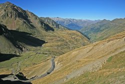
The Pyrenees mountain range offers a spectacular setting for driving enthusiasts, with winding roads that traverse breathtaking landscapes.
Remember to check local regulations, road conditions, and weather before embarking on any driving adventure. Enjoy the scenic beauty and thrilling drives offered by these magnificent routes!
Passable with a Caravan - Pyrenees / Spain
| Name | From / To | Altitude / Max. Gradient | Open Dates | Road Name / Number | Width / Height Restrictions | Notes |
| Puerto de Cabrejas | Tarancon (ES) / Cuenca (ES) | 1167m - 3829ft 14% | Usually open | N400/A40 | Minimum Road Width: 5m (16") | Good road - Sometimes blocked by snow for 24 hours. |
| Port d'Envalira | Soldeu (AD) / Pas-de-la-Casa (AD) | 2407m - 7897ft 12.5% | Occasionally closed from November to April | N22/CG2 | Minimum Road Width: 3.5m (11'6") | Good road with wide bends on ascent and descent - Fine views - Early start recommended in summer to avoid border delays - Envalira Tunnel (toll) reduces congestion and avoids the highest part of the pass. |
| Guadarrama Pass | Guadarrama (ES) / San Rafael (ES) | 1511m - 4957ft 14% | Usually open | NV1 | Minimum Road Width: 6m (19'8") | Northwest of Madrid - May be avoided by using AP6 motorway from Villalba to San Rafael or Villacastin (toll). |
| Name | From / To | Altitude / Max. Gradient | Open Dates | Road Name / Number | Width / Height Restrictions | Notes |
| Ibañeta (Roncevalles) Pass | St Jean-Pied-de-Port (FR) / Pamplona (ES) | 1057m - 3468ft 10% | Usually open | N135 | Minimum Road Width: 4m (13'1") | Slow and winding - Scenic route. |
| Manzanal del Puerto | Combarros (ES) / Bembibre (ES) | 1221m - 4005ft 7% | Usually open | N-V1/A6 | Minimum Road Width: Est. 4m (13'1") | Sometimes blocked by snow for 24 hours. |
| Mirador Puerto de Orduña | Orduña-Urduña (ES) / Berberana (ES) | 900m - 2953ft 15% | Usually open | A625/BU556 | Minimum Road Width: Est. 4m (13'1") | Sometimes blocked by snow for 24 hours - Avoid by using AP68 motorway |
| Name | From / To | Altitude / Max. Gradient | Open Dates | Road Name / Number | Width / Height Restrictions | Notes |
| Puerto del Páramo de Masa | Tubilla del Agua (ES) / Quintanilla Sobresierra (ES) | 1050m - 3445ft 8% | Usually open | N623 | Minimum Road Width: Est. 4m (13'1") | Sometimes blocked by snow for 24 hours. |
| Puerto de Piqueras | Logroño (ES) / Soria (ES) | 1710m - 5610ft 7% | Usually open | N111 | Minimum Road Width: Est. 4m (13'1") | Sometimes blocked by snow for 24 hours. |
| Puerto del Pontón | Riaño (ES) / Cangas-de-Onis (ES) | 1280m - 4200ft 10% | Usually open | N625 | Minimum Road Width: Est. 4m (13'1") | The best approach is from the South. From the North, it is a very long uphill pull with many tight turns. |
| Name | From / To | Altitude / Max. Gradient | Open Dates | Road Name / Number | Width / Height Restrictions | Notes |
| Col de Port | Tarascon-sur-Ariège (FR) / Massat (FR) | 1249m - 4098ft 10% | Usually closed between November and March | D618 | Minimum Road Width: 4m (13'1") | A fairly easy, scenic road - Narrow on some bends. |
| Col de Puymorens | Ax-les-Thermes (FR) / Bourg-Madame (FR) | 1915m - 6283ft 10% | Occasionally closed from November to April | N20 | Minimum Road Width: 5.5m (18") | A generally easy, modern tarmac road - Parallel toll road tunnel available. |
| Col de la Quillane | Axat (FR) / Mont-Louis (FR) | 1714m - 5623ft 8.5% | Occasionally closed from November to March | D118 | Minimum Road Width: 5m (16'5" | An easy, straightforward ascent and descent. |
| Name | From / To | Altitude / Max. Gradient | Open Dates | Road Name / Number | Width / Height Restrictions | Notes |
| Puerto-de-San Glorio | Unquera (ES) / Riaño (ES) | 1609m - 5279ft 12% | Usually open | N621 | Minimum Road Width: 4m (13'1") | Desfiladero de la Hermida has good conditions to Potes - Potes to Puerto-de-San-Glorio is steep with many hairpin bends - For confident drivers only. |
| Somosierra Pass | Santo Tomé del Puerto (ES) / La Serna del Monte (ES) | 1444m - 4738ft 10% | Occasionally closed from December to March | A1/E5 | Minimum Road Width: 7m (23') | May be blocked following snowfalls - Snow-plough swept during winter months - Wheel chains compulsory after snowfalls - Well-surfaced dual carriageway - Tunnel at the summit. |
| Puerto de Somport | Accous (FR) / Jaca (ES) | 1632m - 5354ft 10% | Usually open | N134/N330 | Minimum Road Width: 3.5m (11'6") | A favoured, old-established route - Not particularly easy - Narrow in places - Many unguarded bends on the French side - Excellent road on the Spanish side - Use of road tunnel advised - Re-fuel no later than Sabiñánigo when travelling South to North. |
| Name | From / To | Altitude / Max. Gradient | Open Dates | Road Name / Number | Width / Height Restrictions | Notes |
| Collada de Toses | Puigcerda (ES) / Ribes-de-Freser (ES) | 1800m - 5906ft 10% | Usually open | N260 | Minimum Road Width: 5m (16'5") | Fairly straightforward- Continuously winding, two-lane road - Good road surface - Many sharp bends - Some unguarded edges - Difficult in winter. |
Not recommended for Caravans - Pyrenees / Spain
| Name | From / To | Altitude / Max. Gradient | Open Dates | Road Name / Number | Width / Height Restrictions | Notes |
| Coll d'Ares | Prats-de-Mollo (FR) / Molló (ES) | 1513m - 4964ft 5% | Usually open | D115/C38 | Minimum Road Width: Est. 4m (13'1") | Sometimes closed by snow. |
| Col d'Aubisque | Eaux Bonnes (FR) / Argelés-Gazost (FR) | 1710m - 5610ft 10% | Usually closed mid October to June | D918 | Minimum Road Width: 3.5m (11'6") | Very winding - Continuous but easy ascent - Descent including Col-d’Aubisque 1709m (5607 feet) and Col-du-Soulor 1450m (4757 feet) includes 8km (5 miles) of very narrow, rough, unguarded road with steep drops. |
| Port de la Bonaigua | Viella [Vielha] (ES) / Esterri-d’Aneu (ES) | 2072m - 6796ft 8.5% | Usually closed November to April | C28 | Minimum Road Width: 4.3m (14'1") | Twisting, narrow road - Many hairpin bends - Some precipitous drops - Alternative route to Lerida (Lleida) through Viella (Vielha) Tunnel is open all year. |
| Name | From / To | Altitude / Max. Gradient | Open Dates | Road Name / Number | Width / Height Restrictions | Notes |
| Col de Burdincurutchet | Chapelle Saint-Sauveur d'Iraty (FR) / Larrau (FR) | 1135m - 3724ft 11% | Usually open | D18/D19 | Minimum Road Width: Est. 4m (13'1") | Usually combined with Col d'Haltza - A narrow road leading to Iraty skiing area - Narrow with some tight hairpin bends - Rarely has central white line - Stretches are unguarded - Not for the faint-hearted. |
| Puerto del Escudo | Alceda (ES) / Orbaneja del Castillo (ES) | 1011m - 3317ft 17% | Usually open | N632/A67/N611 | Minimum Road Width: 5m (16'5") | Asphalt surface but many bends and steep gradients. A67/N611 provides an easier route. |
| Col d'Haltza | St Jean-Pied-de-Port (FR) / Chapelle Saint-Sauveur d'Iraty (FR) | 782m - 2565ft 11% | Usually open | D18/D19 | Minimum Road Width: Est. 4m (13'1") | Usually combined with Col de Burdincurutcheta - A narrow road leading to Iraty skiing area - Narrow with some tight hairpin bends - Rarely has central white line - Stretches are unguarded - Not for the faint-hearted. |
| Name | From / To | Altitude / Max. Gradient | Open Dates | Road Name / Number | Width / Height Restrictions | Notes |
| Puerto de Navacerrada | Valsain (ES) / Navacerrada (ES) | 1860m - 6102ft 17% | Occasionally closed from November to March | M601/CL601 | Minimum Road Width: Est. 4m (13'1") | Possible, but not recommended for caravans - Sharp hairpins. |
| Puerto de Pajares | Campumanes (ES) / La Robla (ES) | 1270m - 4167ft 16% | Usually open | N630 | Minimum Road Width: Est. 4m (13'1") | Sometimes blocked by snow for 24 hours - Avoid by using AP66 motorway. |
| Col de Peyresourde | Arreau (FR) / Bagnères-de-Luchon (FR) | 1563m - 5128ft 10% | Usually open | D618 | Minimum Road Width: 4m (13'1") | Somewhat narrow - Several hairpin bends, though not difficult for smaller vehicles. |
| Name | From / To | Altitude / Max. Gradient | Open Dates | Road Name / Number | Width / Height Restrictions | Notes |
| Puerto de Pandetrave | Portilla-de-la-Reina (ES) / Santa Marina-de-Valdeón (ES) | 1562m - 5124ft 12% | Usually open | LE245 | Minimum Road Width: Est. 4m (13'1") | The main street of Santa Marina is very narrow. |
| Portet-d'Aspet | Audressein (FR) / Aspet/Fronsac (FR) | 1069m - 3507ft 14% | Usually open | D618 | Minimum Road Width: 3.5m (11'6") | Approached from West by the easy Col-des-Ares (not recommended for caravans) and Col-de-Buret - Well-engineered but narrow road - Care needed on hairpin bends. |
| Col du Pourtalet | Laruns (FR) / Biescas (ES) | 1792m - 5879ft 10% | Usually closed from late October to early June | A136/D934 | Minimum Road Width: 3.5m (11'6") | A fairly easy, unguarded road - Narrow in places - Easier from Spain via the A136 - Steeper in France via the D934. |
| Name | From / To | Altitude / Max. Gradient | Open Dates | Road Name / Number | Width / Height Restrictions | Notes |
| Col du Tourmalet | Ste Marie-de-Campan (FR) / Luz-St Sauveur (FR) | 2114m - 6936ft 12.5% | Usually closed October to mid June | D918 | Minimum Road Width: 4m (13'1") | The highest French Pyrenean route - Approaches good, though winding - Narrow in places - Exacting over summit - Sufficiently guarded - Rough surface & uneven edges on west side. |
| Urquiola (Urkiola) Pass | Durango (ES) / Otxandio (ES) | 713m - 2340ft 16% | Usually open | BI623/A623 | Minimum Road Width: Est. 4m (13'1") | Sometimes closed by snow for 24 hours. |
Road Tunnels - Pyrenees
| Name | To / From | Length | Height Above Sea Level | Width / Height Restrictions | Notes | Website |
| Túnel de Bielsa-Aragnouet | Aragnouet (FR) / Bielsa (ES) | 3.2km - 2m | 1830m (6000’) | No tolls. | Open 24 hours but occasionally closed between October and Easter - French side (D173) generally has a good road surface but is narrow with steep hairpin bends and steep gradients near the summit - Often no middle white line - Spanish side (A138) has good width and is less steep and winding - Used by heavy vehicles. | www.bielsa-aragnouet.org |
| Túnel del Cadí | Bellver de Cerdanya (ES) / Berga (ES) | 5km - 3m | 1220m (4000’) | Tolls charged. | West of Toses (Tosas) pass on E9/C16 - Link from La Seo de Urgel to Andorra - Excellent approach roads - Heavy weekend traffic. | www.tunelsbarcelonacadi.cat |
| Envalira Tunnel | Pas de la Casa (AD) / El Grau Roig (ES) | 2.8km - 1.75m | 2000m (6562’) | Tunnel Width: 8.25m (27') Tolls charged. | On N22/CG2 France to Andorra. | www.tuneldenvalira.com/en |
| Name | To / From | Length | Height Above Sea Level | Width / Height Restrictions | Notes | Website |
| Tunnel du Puymorens | Ax-les-Thermes (FR) / Puigcerda (ES) | 4.8km - 2.9m | 1515m (4970’) | Maximum Vehicle Height: 3.5m (11’6”) Tolls charged. | Part of Puymorens pass on N20/E9 | N/a |
| Túnel de Somport | Urdos (FR) / Canfranc (ES) | 8.6km - 5.3m | 1116m (3661’) | Tunnel Height 4.55m (14’9”) Maximum Road Width: 10.5m (34’) Max Speed: 90 km/h (56 mph) No tolls. | Leave 100m between vehicles - On N134 (France), N330 (Spain) | N/a |
| Túnel de Viella | Vielha [Viella] (ES) / Pont de Suert (ES) | 5.2km - 3.2m | 1635m (5390’) | Tunnel Height 5.3m (17'3") Maximum Road Width: 12m (39’3") Max Speed: 80 km/h (50 mph) No tolls. | 3-lane, well-lit, modern tunnel on N230 - Gentle gradients on both sides - Good road surface - Narrow on approach from Vielha | N/a |
Gradient Conversion Table
Road gradients can be expressed using ratios or percentages to describe the change in elevation over a certain distance. Both ratios and percentages provide a way to quantify the steepness or incline of a road segment, but they represent the information in different formats:
Ratios: A road gradient expressed as a ratio compares the vertical change (rise) to the horizontal distance (run). For example, a road with a gradient of 1:20 means that for every 1 unit of vertical rise, there is a horizontal run of 20 units.
Percentages: A road gradient expressed as a percentage represents the vertical rise relative to the horizontal distance as a proportion of 100. It is calculated by dividing the vertical rise by the horizontal distance and multiplying by 100. For example, a road with a gradient of 5% means that for every 100 units of horizontal distance, there is a vertical rise of 5 units.
| Percentage | Ratio |
| 20% | 1 in 5 |
| 16.5% | 1 in 6 |
| 14% | 1 in 7 |
| 12.5% | 1 in 8 |
| 11% | 1 in 9 |
| 10% | 1 in 10 |
| 9% | 1 in 11 |
| 8% | 1 in 12 |
| 7.5% | 1 in 13 |
| 7% | 1 in 14 |
| 6.5% | 1 in 15 |
Disclaimer
The information contained on this page is from multiple sources, including The Caravan and Motorhome Club, The AA, The RAC, and other motoring and tourism organisations. Updates and revisions are contributed by caravanners and tourers who have personally used the passes and tunnels. Alan Rogers Travel has not independently verified the information in these tables and cannot be held responsible for their accuracy, errors, omissions, or their consequences.