I've been travelling regularly to Devon for about 15 years, both on holiday and to visit family, and on my most recent visit, I noticed something strange...
Unusual Discoveries on Familiar Roads
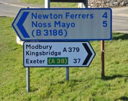
The blue road sign in Yealmpton, Devon
My wife is from Devon, and her family still live in Plymouth; when visiting, we usually stay at the Modbury Caravan and Motorhome Club site. We drive to her parents in Plymouth each day via the A379. I must have driven along this route dozens of times over the years, and we regularly stop off at the local garage in Yealmpton.
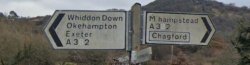
This time whilst passing the petrol station, something unusual caught my eye, a road sign to Noss Mayo with blue writing‽ Initially, I figured it must have faded over time, but then I started to notice more of these strange blue road signs; not only that, but I also spotted some weird brown signs. These weren't the standard Department for Transport brown usually used for pointing the way to tourist attractions; no, these were a light golden brown pointing the way to small Devon villages and hamlets.
The Purpose Behind the Signage System
An internet search revealed little information, but a leaflet published by the Engineering and Planning Department of Devon County Council in 1992 can be found buried deep on the council's website. This leaflet gives away some clues about the hidden purpose of the signage.
The following extracts from the leaflet explain the reason(s) behind Devon's colourful road signs.
DEVON'S MINOR ROUTE SIGNING
Many of the roads in Devon are winding, hilly and very narrow. To help you choose the best way to your destination, the County Council has identified a network of roads varying from main roads down to those which are only suitable for cars or essential delivery vehicles.
Once you have decided where you want to go, simply use the highest class of road available, only using the lower classes when you are near to your destination and a more suitable route is not available.
Are the council simply trying to help the hapless tourist or lost locals get to their location as efficiently as possible?
DEVON ROAD NETWORK
Devon has developed a highly effective system to ensure that the limited funds available for road maintenance are used to best effect. It relies on grading the road network into different categories, depending on the suitability of each route.
The different grades of road are distinguished by a unique signing system which is shown here in detail. Using the most suitable routes will get you to your destination more safely and quickly and save on road maintenance costs.
It was all about cost and asset management rather than a scheme to reduce congestion on Devon's minor roads. Not surprising, given that Devon County Council has one of the most extensive highway networks in the UK, comprising over 12,000 kilometres of road and 5,700 kilometres of public rights of way to maintain, that's excluding those in the City of Plymouth, the Borough of Torbay along with the Motorways and Trunk Roads, which are the responsibility of the Highways Agency.
Decoding Devon's Colourful Road Signs
Throughout Devon, you'll encounter various types of signage, some more familiar, like the standard Department for Transport Motorway signs, other styles are unique to this corner of the world.
National Road Signage
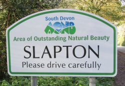
Welcome to Slapton
These are the signs most of us are familiar with and indicate national through routes which are suited to all vehicles:
Motorway Signs - Blue with a white border and text.
Primary Route Signs - Green with a white border, text and yellow route numbers.
Other Main Road Signs - White with a black frame and text, suitable for MOST vehicles.
Devon Specific Road Signage
This unique signing system shows Devon road users at a glance the sort of road they are about to use.
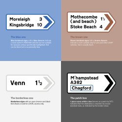
MEDIUM vehicles only
Blue-bordered signs with a blue chevron indicate a route suited to MEDIUM vehicles but not suitable for caravans unless specifically highlighted. Text can be black but is occasionally blue.
This shouldn't be confused with the 1957 style "Local Direction" signage which has a blue border, black lettering and a black chevron, these should have been removed by the end of 2014, but can still be found throughout the country.
A Blue Devon Road Sign
LIGHT vehicles only
Brown-bordered signs with a brown chevron indicate a route suitable only for cars and other LIGHT vehicles. Text is usually black.
A Brown Devon Road Sign
LOCAL access only
Borderless signs with an open chevron and black text - This shows a route for LOCAL access only.
A White Devon Road Sign - No Diagram Required?
Colour Patches
A place name within a box (known as a patch by the DfT) indicates that the destination is reached via a lower standard route, as indicated by the border colour.
A Devon Road Sign with a Blue Block
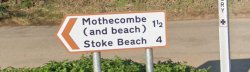
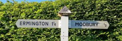
Fingerposts
On minor roads, the signs are, more often than not, traditional fingerposts, which may incorporate junction names and the Devon county logo on the top.
A traditional Devon Fingerpost - How far to Modbury?
In summary
So whilst it was primarily a scheme aimed at reducing costs by reducing traffic on more minor rural roads, there is a benefit to following the code and only using a lower-grade road when a higher grade is unavailable.
Hazards Unveiled: What the Signs Don't Mention
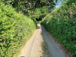
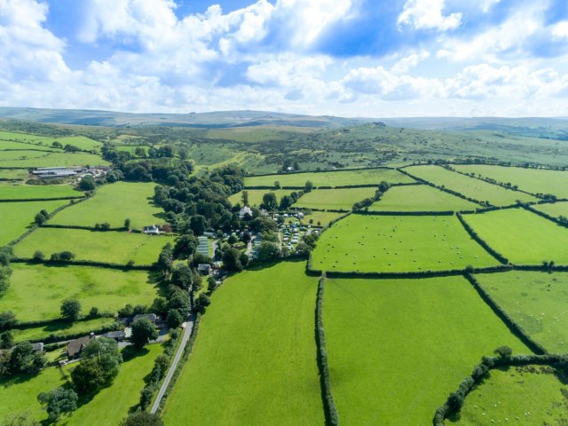
A typical Devon lane
Of course, the signs don't mention the unforeseen hazards you may encounter while travelling on a minor road.
These hazards could include stray animals, horse riders, walkers and cyclists and other leisure vehicle drivers carefully navigating the same potential dangers as yourself, not to mention challenging bends, high bankings, steep hills, and more.
The Rise and Fall of the Scheme
Following a successful trial in the Dartmoor National Park in the late 1980s, the signage was rolled out to the rest of Devon in 1992.
The scheme was initially promoted via leaflets handed out at tourist information centres and on signage at the entrance to the county.
But by 2000, all mention of the project had been quietly dropped from the Council website, and explainer signs began to fall into disrepair.
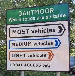
The Last Explainer Sign
Devon and Dartmoor Road Suitability Sign
But wait, there is hope for the scheme. In June 2022 the sign at the entrance to the Dartmoor National Park, just off the South Brent junction of the A38/A385, was replaced with a new sign.
So far as we can tell, this is the only remaining explainer sign (as well as touring the county extensively, we've also spent a lot of time on Google Maps!), but to be sure, we've submitted a Freedom of Information Request to the council and will update this blog when we get a response.
Update: - We received a response to our FOI request on 27th June 2023 confirming that this is the last remaining sign in Devon.
The Devon is in the details
Eight quick facts about Devon
The only county in England to have two coasts.
More than 200 Sites of Special Scientific Interest.
Mill Park is a small family-run sheltered touring caravan and camping site set in an attractive wooded valley on the North Devon Coast. It has a shop, a takeaway, a games room, laundry, and many other facilities such as gas-changing and ice pack freezing. Several glamping options, including three bell tents and three glamping pods, are available on-site. There is also an on-site pub serving a modest menu. Mill Park is surrounded by attractive woodland and is an ideal family site as it's just a short walk to quiet sand and pebble beaches.
Situated on the southwest edge of Dartmoor, this holiday park has been developed on the grounds of the old Langstone Manor house. The touring pitches are tucked into various garden areas with mature trees and flowering shrubs or in the walled garden area with views over the moor. There are 40 level grass pitches, which vary in size (35 with 16A electricity). A popular camping area has been terraced with open views over farmland and the moor.
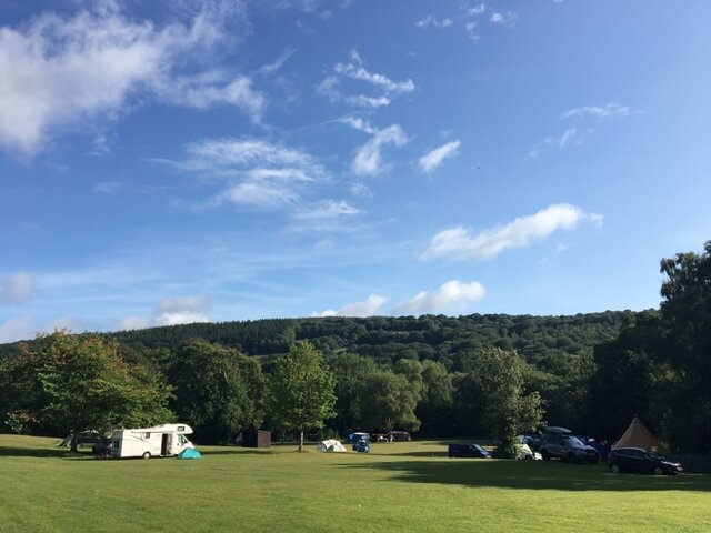
River Dart Country Park is an award-winning campsite on the southeastern edge of Dartmoor National Park. With excellent camping facilities and generously-sized pitches, it is the ideal holiday base for exploring the surrounding area. There are 280 individual pitches of a reasonable size and in different locations, some of which are slightly sloping. There are 138 pitches with electrical connections (10/16A) and 35 with hardstanding. All visitors to the site have free access to the extensive adventure playgrounds. There are also Dare Devil activities on site which include a high ropes course, mega zip wire, canoeing and kayaking – extra cost. There really is an adventure around every corner!
Parkland is in an area of outstanding natural beauty and ideally situated for exploring all the stunning South Hams area of South Devon has to offer. Open all year, the site is set within three acres of mature, landscaped grounds with panoramic views over Kingsbridge and Salcombe and the rolling countryside towards Dartmoor National Park.
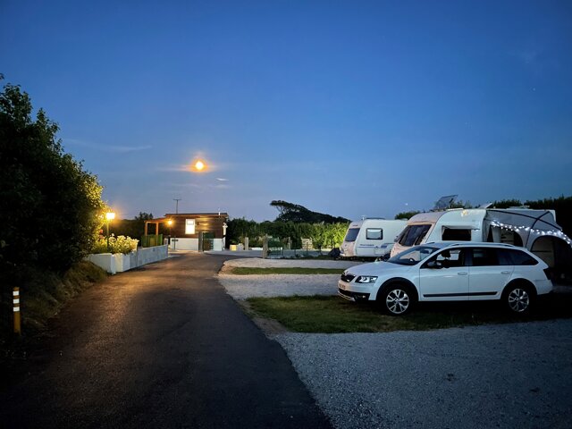
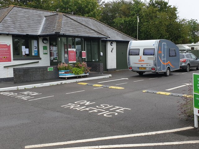
Modbury Caravan and Motorhome Club site is situated within easy distance to the ancient village of Modbury. Nestled cosily between the moors and the sea, it is the perfect base from which to explore the charming surrounds of South Devon. The site offers you the pleasant choice between the quiet and solitude of beautiful Dartmoor with its tumbling streams, historic landscapes and lush views or the many small villages that make up the pleasantly rural South Hams. The site has 114 grass/hardstanding pitches (some seasonal) all with electricity 16amp. No arrivals before 1.00pm.
Rob has been involved in the leisure industry since completing a BTEC in Travel & Tourism in 1993. Previous roles have included the promotion of tourism in Yorkshire and running a motorcycle touring company in the Australian Outback.
He is the General Manager at Alan Rogers Travel Group, responsible for the ongoing development of the Alan Rogers website and the publication of the Alan Rogers Guides and 'Destinations' magazine.
Rob has owned several caravans, and he regularly travels with his wife and young daughter in their VW Transporter, complete with a Tentbox roof tent. A keen cycling fan, Rob can often be found in a field in Belgium during the 'Spring Classics' season.
Deeply ingrained in Britain's culture and history, the UK's UNESCO sites demonstrate pioneering Victorian industrial heritage and mining culture. Devon's Jurassic Coast and Northern Ireland's Giant's Causeway make up the share of natural sites.