Ref: NL5661
Texelcamping Loodsmansduin
Netherlands, Noord-Holland, Den Hoorn
- Tel:
- +31 222 317 208
- Open:
- 28 March - 1 November.


Alan Rogers Review of Texelcamping Loodsmansduin
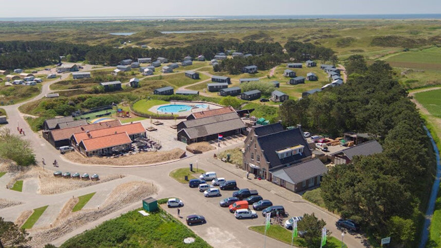
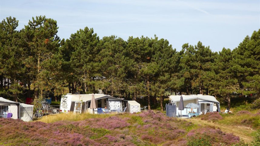
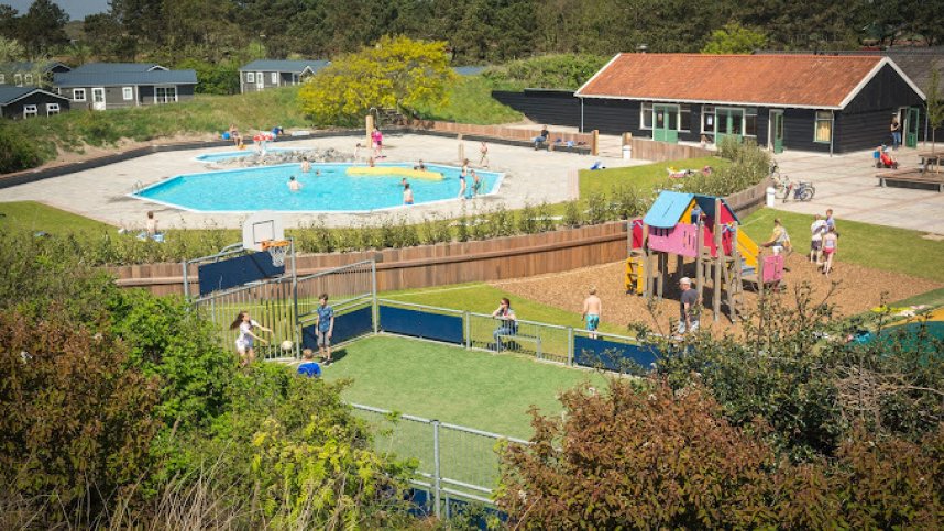
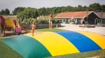
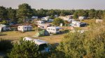
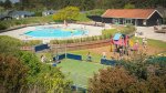
The recently renovated Texelcamping Loodsmansduin is located in Texel’s Nationaal Park Duinen in one of the least developed parts of the island. For motorhome owners, hardstandings are available but there are also large, grassy pitches located between the dunes and heather. There are also 60 chalets to rent and a number of hikers’ cabins. All pitches are equipped with 16A electricity and TV connections. Leisure amenities include a tennis court, a football pitch and a heated swimming pool. For children, there is a professional entertainment team during May and in the summer holidays. Close to the site, the village of Den Hoorn, with its Michelin-starred restaurant, is an attractive spot for a delicious meal.
Arguably, the island’s best cycle routes run from Den Hoorn, passing through the polder or through the dunes. Alternatively, riding on the beach is also popular and there are some excellent footpaths. The island’s history is brought to life in its seven museums; these include the ‘Luchtvaart- en oorlogsmuseum Texel’ dedicated to aviation history. The sculpture exhibition at the ‘De Wije Blik’ gardens is also definitely worth seeing.
Facilities at Texelcamping Loodsmansduin
Modern, heated sanitary blocks with hot showers, family rooms and baby baths. Launderette. Shop. Bar. Snack bar/restaurant. Swimming pool. Play areas. Tennis. Sports field. Entertainment and activity programme. Bicycle hire. WiFi (charged). Mobile homes and hikers’ cabins to rent.
Green Credentials
Directions to Texelcamping Loodsmansduin
The site is located to the south of the island. The ferry departs from Den Helder. Upon arrival on the island follow the Pontweg as far as the first roundabout. Follow signs to Den Hoorn. This is Hoornderweg, which ends at a T-junction. Turn left at the top, then first right (Lage Wegje). Continue to the end, then turn left. The site is 300 m. further.
| Postcode | Latitude, Longitude | what3words (What is this?) | Directions (from your current location) |
|---|---|---|---|
| Postcode: NL-1797 RN | Latitude, Longitude: 53.02144, 4.741 | ///telescopic.fidgets.hopped | Directions To Campsite Via Google Maps |
Campsite Google Map
The following consent is required:
Tracking & performance, Targeting & advertising.
Campsites Near-by